- Aerial Imaging solutions, which provide high-resolution imagery from platforms such as UAVs/drones, helicopters, and fixed-wing aircraft, are becoming indispensable tools across diverse sectors including agriculture, defense, construction, real estate, and environmental monitoring, due to their ability to deliver detailed visual data, geographic insights, and real-time situational awareness.
- The growing demand for geospatial intelligence, precision agriculture, urban planning, and disaster management is significantly driving the adoption of aerial imaging technologies. Industries increasingly rely on these solutions to optimize operations, reduce costs, and improve decision-making, especially when integrated with AI, GIS, and remote sensing technologies.
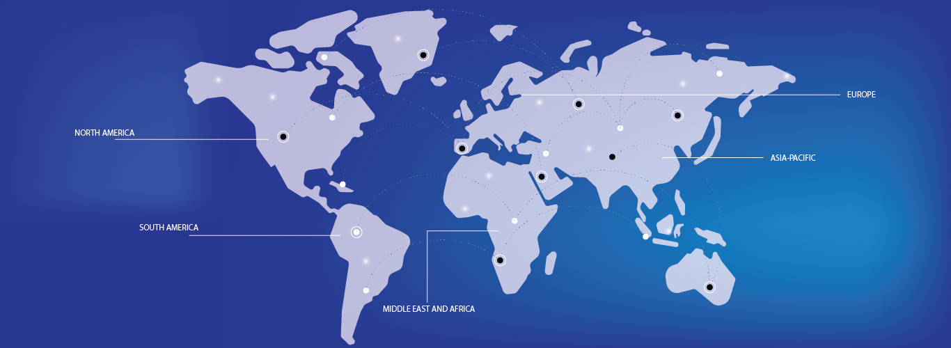
- North America dominates the Aerial Imaging market with the largest revenue share of 36.2% in 2024, driven by strong defense expenditure, advanced infrastructure, and early adoption of UAV-based imaging technologies. The United States, in particular, witnesses robust investments in smart agriculture, infrastructure monitoring, and homeland security, which utilize aerial imagery extensively.
- Asia-Pacific is expected to be the fastest-growing region in the Aerial Imaging market during the forecast period, fueled by rapid urbanization, infrastructure development, and government initiatives promoting digital mapping, smart city projects, and agricultural modernization in countries such as China, India, and Japan.
- The UAVs/Drones segment dominates the Aerial Imaging market with a market share of 43.2% in 2024, owing to their cost-effectiveness, flexibility, and ease of deployment compared to manned aircraft. These platforms are widely used for applications ranging from crop health analysis and mining exploration to real estate visualization and traffic management, making them the preferred aerial imaging method across multiple end-user industries.