تُستخدم تقنية الاستشعار عن بُعد في تطبيقات متنوعة في الزراعة، والرصد البيئي، والدفاع، وتخطيط المدن. ويتمثل قطاعها الرئيسي في رصد الأرض والرصد البيئي. وتلعب تقنية الاستشعار عن بُعد، بما في ذلك الأقمار الصناعية والطائرات المسيرة، دورًا محوريًا في جمع البيانات المهمة لرصد المناخ، وإدارة الموارد الطبيعية، والاستجابة للكوارث، وتقييم النظم البيئية. ويستمر هذا القطاع في التوسع نظرًا للمخاوف البيئية المتزايدة والحاجة إلى اتخاذ قرارات قائمة على البيانات.
يمكنك الوصول إلى التقرير الكامل على https://www.databridgemarketresearch.com/reports/global-remote-sensing-technology-market
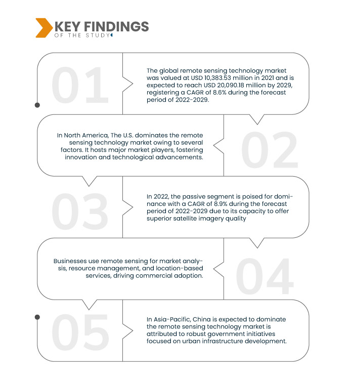
تشير تحليلات شركة داتا بريدج لأبحاث السوق إلى أن قيمة سوق تكنولوجيا الاستشعار عن بُعد العالمية بلغت 10,383.53 مليون دولار أمريكي في عام 2021، ومن المتوقع أن تصل إلى 20,090.18 مليون دولار أمريكي بحلول عام 2029، مسجلةً معدل نمو سنوي مركب قدره 8.6% خلال الفترة المتوقعة 2022-2029. في قطاع الإنشاءات والبنية التحتية، تُساعد تكنولوجيا الاستشعار عن بُعد في اختيار المواقع المثلى للمشاريع، وتخطيط المخططات، ومراقبة التقدم. كما تُوفر بيانات قيّمة حول التضاريس والعوامل البيئية والتغيرات أثناء الإنشاء، مما يُعزز كفاءة المشروع وفعاليته من حيث التكلفة.
النتائج الرئيسية للدراسة
ومن المتوقع أن تدفع الزراعة والزراعة الدقيقة معدل نمو السوق
تُسخّر الزراعة الدقيقة بيانات الاستشعار عن بُعد لإحداث ثورة في الممارسات الزراعية. فمن خلال تحليل بيانات الأقمار الصناعية والطائرات المسيّرة، يُمكن للمزارعين تحديد التغيرات في جودة التربة، وصحة المحاصيل، ومستويات الرطوبة في مختلف الحقول. تُمكّن هذه المعرفة من إجراء تعديلات دقيقة في الري والتسميد وتخصيص الموارد، مما يُؤدي إلى زيادة غلة المحاصيل وتقليل هدر الموارد. ويلعب الاستشعار عن بُعد دورًا حيويًا في الزراعة المستدامة والفعّالة، إذ يضمن الاستخدام الأمثل للموارد لتعزيز الإنتاجية.
نطاق التقرير وتقسيم السوق
مقياس التقرير
|
تفاصيل
|
فترة التنبؤ
|
من 2022 إلى 2029
|
سنة الأساس
|
2021
|
السنوات التاريخية
|
2020 (قابلة للتخصيص حتى 2014-2019)
|
الوحدات الكمية
|
الإيرادات بالملايين من الدولارات الأمريكية، والحجم بالوحدات، والتسعير بالدولار الأمريكي
|
القطاعات المغطاة
|
النوع (سلبي ونشط)، نوع النظام (نظام الاستشعار عن بُعد البصري، الاستشعار عن بُعد بالأشعة تحت الحمراء، الاستشعار عن بُعد البصري، الاستشعار عن بُعد بالموجات الدقيقة، الاستشعار عن بُعد بالرادار، الاستشعار عن بُعد الجوي، الاستشعار عن بُعد بالأقمار الصناعية، والاستشعار عن بُعد الصوتي والقريب من الصوتي)، دقة الصورة (مصادر ذات دقة مكانية منخفضة (>30 مترًا)، أقمار صناعية ذات دقة متوسطة (5-30 مترًا)، صناعة عالية الدقة (1-5 أمتار)، وصناعة عالية الدقة جدًا (<1 متر))، التطبيق (تقييم المناظر الطبيعية، الأمن، جودة الهواء، علم المياه، الغابات، رسم خرائط السهول الفيضية وإدارة الطوارئ، الرعاية الصحية، الجيولوجيا واستكشاف المعادن، علم المحيطات، الزراعة وغيرها)
|
الدول المغطاة
|
الولايات المتحدة وكندا والمكسيك في أمريكا الشمالية، ألمانيا، فرنسا، المملكة المتحدة، هولندا، سويسرا، بلجيكا، روسيا، إيطاليا، إسبانيا، تركيا، بقية دول أوروبا في أوروبا، الصين، اليابان، الهند، كوريا الجنوبية، سنغافورة، ماليزيا، أستراليا، تايلاند، إندونيسيا، الفلبين، بقية دول آسيا والمحيط الهادئ (APAC) في منطقة آسيا والمحيط الهادئ (APAC)، المملكة العربية السعودية، الإمارات العربية المتحدة، جنوب أفريقيا، مصر، إسرائيل، بقية دول الشرق الأوسط وأفريقيا (MEA) كجزء من الشرق الأوسط وأفريقيا (MEA)، البرازيل والأرجنتين وبقية دول أمريكا الجنوبية كجزء من أمريكا الجنوبية
|
الجهات الفاعلة في السوق المغطاة
|
نورثروب جرومان (الولايات المتحدة)، شركة الاستشعار الجوي (الولايات المتحدة)، شركة آي تي تي (الولايات المتحدة)، لايكا جيوسيستمز إيه جي - جزء من هيكساغون (سويسرا)، شركة لوكهيد مارتن (الولايات المتحدة)، هانيويل إنترناشونال (الولايات المتحدة)، مجموعة تاليس (فرنسا)، أوربيتال إنسايت (الولايات المتحدة)، سيريس إميجينغ (الولايات المتحدة)، شركة ساتلايت إميجينغ (الولايات المتحدة)، ديكارت لابس (الولايات المتحدة)، أسترو ديجيتال يو إس (الولايات المتحدة)، سلانت رانج (الولايات المتحدة)، تقنيات قياس القطرات (الولايات المتحدة)، إيرباص (هولندا)، فارمرز إيدج (كندا)، مجموعة سكانكس (روسيا)، سبيس ناو (الولايات المتحدة)، شركة رايثيون تكنولوجيز (الولايات المتحدة)، تيرا ريموت سينسينغ (كندا)، بريسيجن هوك (الولايات المتحدة)
|
نقاط البيانات التي يغطيها التقرير
|
بالإضافة إلى الرؤى حول سيناريوهات السوق مثل القيمة السوقية ومعدل النمو والتجزئة والتغطية الجغرافية واللاعبين الرئيسيين، فإن تقارير السوق التي تم إعدادها بواسطة Data Bridge Market Research تتضمن أيضًا تحليلًا متعمقًا من الخبراء والإنتاج والقدرة التمثيلية الجغرافية للشركة وتخطيطات الشبكة للموزعين والشركاء وتحليل اتجاهات الأسعار التفصيلية والمحدثة وتحليل العجز في سلسلة التوريد والطلب.
|
تحليل القطاعات:
يتم تقسيم سوق تكنولوجيا الاستشعار عن بعد إلى أربعة قطاعات بارزة تعتمد على النوع ونوع النظام ودقة الصورة والتطبيق.
- بناءً على النوع، يُقسّم سوق تقنيات الاستشعار عن بُعد العالمي إلى نشط وسلبي. في عام 2022، من المتوقع أن يستحوذ القطاع السلبي على الهيمنة بمعدل نمو سنوي مركب قدره 8.9% خلال الفترة المتوقعة من 2022 إلى 2029، بفضل قدرته على توفير صور أقمار صناعية بجودة فائقة.
في عام 2022، من المتوقع أن يهيمن قطاع النوع السلبي على سوق تكنولوجيا الاستشعار عن بعد العالمية
في عام ٢٠٢٢، من المتوقع أن يتصدر قطاع التصوير السلبي المشهد بمعدل نمو سنوي مركب قدره ٨.٩٪ خلال الفترة المتوقعة ٢٠٢٢-٢٠٢٩، بفضل قدرته على توفير صور أقمار صناعية عالية الجودة. تُستخدم هذه التقنية على نطاق واسع في رصد الأرض، حيث تلتقط بيانات مفصلة وعالية الدقة، مما يجعلها الخيار الأمثل في مختلف القطاعات لرصد ودراسة العمليات الديناميكية لكوكبنا.
- بناءً على نوع النظام، يُقسّم سوق تقنيات الاستشعار عن بُعد إلى أنظمة الاستشعار البصري، والاستشعار بالأشعة تحت الحمراء، والاستشعار البصري، والاستشعار بالموجات الدقيقة، والاستشعار الراداري، والاستشعار الجوي، والاستشعار عبر الأقمار الصناعية، والاستشعار الصوتي وشبه الصوتي. في عام 2022، من المتوقع أن يتصدر قطاع الاستشعار الراداري السوق بمعدل نمو سنوي مركب قدره 9.8% خلال الفترة المتوقعة من 2022 إلى 2029، بفضل قدرته على إرسال واستقبال إشارات لاسلكية واضحة وخالية من الضوضاء.
في عام 2022، من المتوقع أن يهيمن قطاع الاستشعار عن بعد بالرادار من قطاع نوع النظام على سوق تكنولوجيا الاستشعار عن بعد العالمية
في عام ٢٠٢٢، من المتوقع أن يتصدر قطاع الاستشعار عن بُعد بالرادار السوق بمعدل نمو سنوي مركب قدره ٩.٨٪ خلال الفترة المتوقعة ٢٠٢٢-٢٠٢٩، بفضل قدرته على إرسال واستقبال إشارات لاسلكية واضحة وخالية من الضوضاء. تتميز هذه التقنية بفعاليتها العالية في نشر البيانات ونقلها، مما يجعلها خيارًا مثاليًا للتطبيقات التي تتطلب استرجاعًا دقيقًا وموثوقًا للمعلومات، مثل أنظمة مراقبة البيئة والدفاع.
- بناءً على دقة الصورة، يُقسّم سوق تقنيات الاستشعار عن بُعد إلى مصادر ذات دقة مكانية منخفضة (>30 مترًا)، وأقمار صناعية متوسطة الدقة (5-30 مترًا)، وصناعات عالية الدقة (1-5 أمتار)، وصناعات عالية الدقة جدًا (أقل من متر واحد). في عام 2022، من المتوقع أن تتصدر المصادر ذات الدقة المكانية المنخفضة (>30 مترًا) السوق بمعدل نمو سنوي مركب قدره 9.0% خلال الفترة المتوقعة من 2022 إلى 2029. وتُفضّل هذه المصادر لخصائصها الاستثنائية في مقاومة اللهب وتعدد استخداماتها في مختلف التطبيقات الصناعية، مما يجعلها الخيار الأمثل للصناعات التي تُعد مقاومة الحريق عاملاً حاسمًا.
- بناءً على التطبيق، يُقسّم سوق تقنيات الاستشعار عن بُعد إلى تقييم المناظر الطبيعية، والأمن، وجودة الهواء، وعلم المياه، والغابات، ورسم خرائط السهول الفيضية وإدارة الطوارئ، والرعاية الصحية، والجيولوجيا واستكشاف المعادن، وعلم المحيطات، والزراعة، وغيرها. في عام 2022، من المتوقع أن يستحوذ قطاع تقييم المناظر الطبيعية على السوق بمعدل نمو سنوي مركب قدره 9.6% خلال الفترة المتوقعة 2022-2029، نظرًا لدوره المحوري في ضمان الإدارة المستدامة للمناظر الطبيعية وتطويرها. يُعد هذا النهج حيويًا للاستخدام المسؤول للأراضي، والحفاظ عليها، والتخطيط البيئي، مما يجعله عنصرًا أساسيًا في مختلف الصناعات.
اللاعبون الرئيسيون
تعترف شركة Data Bridge Market Research بالشركات التالية باعتبارها اللاعبين الرئيسيين في سوق تكنولوجيا الاستشعار عن بعد العالمية في سوق تكنولوجيا الاستشعار عن بعد العالمية Northrop Grumman (الولايات المتحدة)، The Airborne Sensing Corporation (الولايات المتحدة)، ITT Inc. (الولايات المتحدة)، Leica Geosystems AG - جزء من Hexagon (سويسرا)، Lockheed Martin Corporation (الولايات المتحدة)، Honeywell International Inc. (الولايات المتحدة)، Thales Group (فرنسا)، Orbital Insight (الولايات المتحدة)، Ceres Imaging (الولايات المتحدة)، Satellite Imaging Corporation (الولايات المتحدة)، Descartes Labs، Inc. (الولايات المتحدة)، Astro Digital US (الولايات المتحدة)، SlantRange، Inc. (الولايات المتحدة).
تطورات السوق
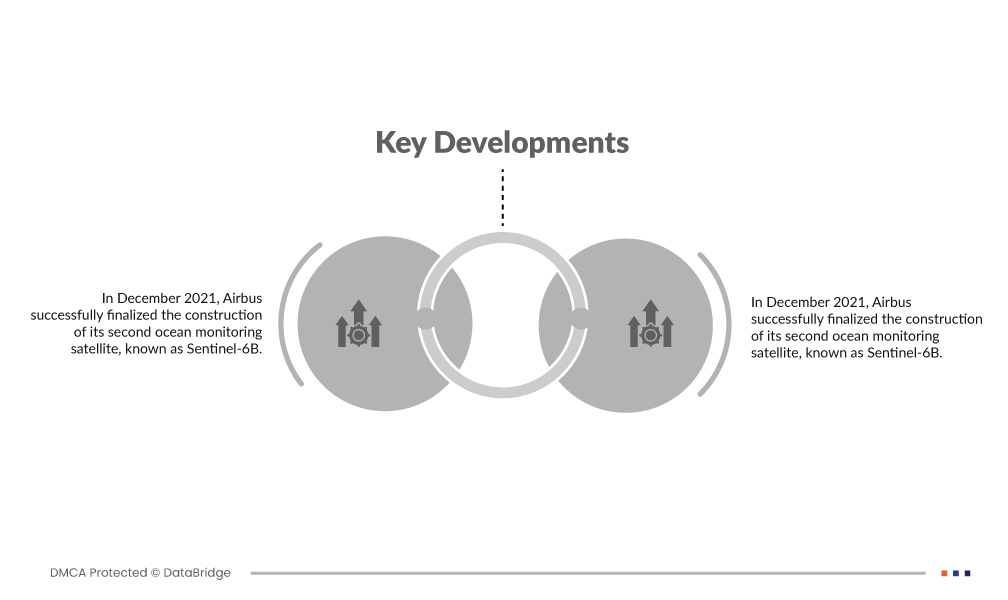
- في ديسمبر 2021، نجحت شركة إيرباص في بناء قمرها الصناعي الثاني لرصد المحيطات، المعروف باسم سنتينل-6بي. صُمم هذا القمر الصناعي المتطور خصيصًا لقياس المسافة إلى سطح البحر بدقة تصل إلى بضعة سنتيمترات. وتتمحور مهمته الرئيسية حول التقييم الدقيق لارتفاعات سطح البحر، ورصد تقلبات مستويات المحيطات، ورصد تيارات المحيطات وتحليلها لتعزيز فهمنا لمحيطات الأرض.
- في يناير 2022، حققت شركة نورثروب غرومان إنجازًا هامًا بإجراء اختبار ثابت ناجح لمحرك صاروخي دقيق الضربة. شكّل هذا الاختبار خطوةً حاسمةً في التحقق من صحة تصميم محرك الشركة كجزء من عملية الإنتاج. ويلعب التزام نورثروب غرومان بالتقنيات الرقمية دورًا محوريًا في جعل مرافق إنتاج محركات الصواريخ الصلبة التكتيكية أكثر فعالية من حيث التكلفة وحداثةً وكفاءةً، مما يضمن أسعار منتجاتها في متناول الجميع.
التحليل الإقليمي
جغرافيًا، البلدان التي يغطيها تقرير سوق تكنولوجيا الاستشعار عن بعد العالمي الرئيسي هي الولايات المتحدة وكندا والمكسيك في أمريكا الشمالية وألمانيا وفرنسا والمملكة المتحدة وهولندا وسويسرا وبلجيكا وروسيا وإيطاليا وإسبانيا وتركيا وبقية أوروبا في أوروبا والصين واليابان والهند وكوريا الجنوبية وسنغافورة وماليزيا وأستراليا وتايلاند وإندونيسيا والفلبين وبقية دول آسيا والمحيط الهادئ (APAC) في منطقة آسيا والمحيط الهادئ (APAC) والمملكة العربية السعودية والإمارات العربية المتحدة وجنوب إفريقيا ومصر وإسرائيل وبقية دول الشرق الأوسط وأفريقيا (MEA) كجزء من الشرق الأوسط وأفريقيا (MEA) والبرازيل والأرجنتين وبقية دول أمريكا الجنوبية كجزء من أمريكا الجنوبية.
وفقًا لتحليل Data Bridge Market Research:
تهيمن أمريكا الشمالية على سوق تكنولوجيا الاستشعار عن بعد العالمية خلال الفترة المتوقعة 2022-2029
في أمريكا الشمالية، تُهيمن الولايات المتحدة الأمريكية على سوق تقنيات الاستشعار عن بُعد لعدة عوامل. فهي تستضيف جهات فاعلة رئيسية في السوق، مما يُعزز الابتكار والتقدم التكنولوجي. إضافةً إلى ذلك، تتبنى البلاد تقنية الاستشعار عن بُعد على نطاق واسع في تطبيقات مُختلفة، بما في ذلك الزراعة والدفاع والرصد البيئي والتخطيط العمراني. كما تُعزز استثمارات الحكومة الأمريكية في برامج الأقمار الصناعية والأبحاث ريادتها. كما أن استخدامها المُكثف لتقنية الاستشعار عن بُعد في القطاعين العام والخاص يُعزز مكانتها البارزة في السوق.
من المتوقع أن تهيمن منطقة آسيا والمحيط الهادئ على سوق تكنولوجيا الاستشعار عن بعد العالمية خلال الفترة المتوقعة 2022 - 2029
في منطقة آسيا والمحيط الهادئ، من المتوقع أن تهيمن الصين على سوق تقنيات الاستشعار عن بُعد، ويعزى ذلك إلى المبادرات الحكومية القوية التي تُركز على تطوير البنية التحتية الحضرية. وتستثمر الحكومة الصينية بكثافة في برامج الأقمار الصناعية، ورصد الأرض، ومشاريع المدن الذكية، مما يُعزز الطلب على تقنيات الاستشعار عن بُعد. هذا التركيز الاستراتيجي على التنمية الحضرية يُرسّخ مكانة الصين كلاعب رئيسي، مُستفيدةً من بيانات الاستشعار عن بُعد في التخطيط والرصد والإدارة الفعّالة للمدن سريعة النمو. يُسهم هذا النهج الاستباقي بشكل كبير في الريادة المُتوقعة للصين في هذا السوق.
لمزيد من المعلومات التفصيلية حول تقرير سوق تكنولوجيا الاستشعار عن بعد العالمي، انقر هنا - https://www.databridgemarketresearch.com/reports/global-remote-sensing-technology-market
